Showing posts with label Extreme weather. Show all posts

Tuesday, March 28, 2017

Cyclone Debbie, the eyes of the nation watch North Queensland.


 Cyclone Debbie is bearing down on the North Queensland coast around Mackay and the Whitsunday Islands.  Forecast to cross the coast just before 11:00am today Tuesday, 28th March.   Wind gusts forecast to be 250klm an hour.

 http://www.abc.net.au/news/2017-03-28/cyclone-debbie-makes-landfall-in-north-queensland-live-blog/8391312

The main concern for the Mackay area is the storm surge with the high tide occurring simultaneously!  Will Debbie make the list of worst cyclones ever to hit the coast of Queensland.


 Live streaming to ABC North Queensland here : https://radio.abc.net.au/stations/itinerant_one/live

 A bit of History on Australian cyclones since white settlement.

 1899 - Category five Tropical Cyclone Mahina  March 4th
Over 400 people killed and the storm surge left porpoises on the tops of cliffs and the destruction was made worse by another cyclone Monsoonal Disturbance Nachon coming at them from the west over the Arafura Sea at the same time.

1918 - Category four Tropical Cyclone Mackay.  January 21st
30 lives were lost in Mackay when this cyclone crossed the coast.  Reports of wave coming into the main street up to 9ft high which is about 3 meters. 

1918 - Category five Cyclone Innisfail.  March 10th
Just after Mackay in January it was Innisfail's turn in March and only 12 houses in the town left standing and 100 people dead in the area.

2006 - Category four Cyclone Larry Innisfail.  March 20th
Worst in three generations the BOM said and that is correct .. since 1918.  10,000 homes were damaged and crops were lost and the economic loss was around $1.5 Billion  and no lives were lost.

2011 - Category five Cyclone Yasi at Far North Queensland at Mission Beach.  February 3rd
Wind gusts estimated at 285 kilometres per hour. Yasi tracked 1000 kilometers inland to Mt Isa with the intensity of a tropical low over the next 20 hours.

Devastation in Edith Street, Innisfail after a cyclone in 1918
Image of Innisfail March 10th 1918  Photo State Library of Queensland

The Cyclone is a large one and the weather reports show it tracking inland when it finally makes land fall and heading in sweeping southerly direction above or around Emerald. 

Brisbane and the Gold Coast and Northern NSW will need to brace themselves as the rain sweeps down pushed by arctic winds from the south.  

I have organized sandbags for the side of our shed from the local SES.  My friend has already received an SMS warning from her insurance company to expect up to 400m of rain in this area where we are on the mountain.  This is why I organized sandbags.  One side of the shed is vulnerable and my furniture is in there.  Better to do it now that when its too late.

UpDate 31st March 2017: Earlier this morning ... The omens were in the sky. The big birds ... lots of gigantic wings and then a heart. This is a personal omen and in past times it has always been death.

Image may contain: sky, cloud and outdoor

Image may contain: cloud, sky, night, outdoor and nature

Image may contain: sky, cloud, tree, outdoor and nature

UpDate 3rd April 2017:  5 people dead and 3 still missing.
http://www.news.com.au/technology/environment/queensland-cyclone-debbie-five-people-killed-in-horror-weather/news-story/1d2d9148a0f3e4500f4da13540d17628

Update from New Zealand 3rd April 2017 :  The remnants of Tropical Cyclone Debbie are threatening to develop into a serious situation in the next 72 hours
http://m.nzherald.co.nz/nz/news/article.cfm?c_id=1&objectid=11830617

Images @ Eminpee Fotography

Friday, December 09, 2016

Tsunami Warning issued.. Solomon Islands rocked by 8.0 Quake today!

Map showing the epicentre of the Friday morning's earthquake.

A tsunami warning has been issued for the Solomon Islands, Vanuatu, Papua New Guinea, and Nauru after a massive 8.0. magnitude earthquake struck 70km off the Solomon Islands. 

According to USGS,  “Widespread hazardous tsunami waves are possible.” This was the stated warning issued by the Pacific Tsunami Warning Center this morning.
"Just people running with their belongings, with their kids and all that to the main road, [trying] to get away as far from the coast as possible in fear of a tsunami."  - Solomon Islands Broadcasting Corporation journalist Georgina Kekea.

READ MORE:
http://www.smh.com.au/world/tsunami-warning-after-strong-earthquake-strikes-near-solomon-islands-20161208-gt7ar2.html
http://www.abc.net.au/…/solomon-islands-rocked-by-p…/8105686
http://www.disclose.tv/…/apocalyptic_80_earthquake_h…/136913
So the Solomon Islands were named by the Spanish navigator Alvaro de Mendana in 1568.    Its a Constitutional Monarchy today with Queen Elizabeth II the head of state.  Manasseh Sogavare is the current Prime Minister.  There Parliament buildings were a gift from the United States of America.
  • The name Solomon is from our two luminaries, the Sun and the Moon in combination.  This means Right and Left Brain balance. Both hemispheres working together in a balanced nature minus the programming.     Creativity and Action in balance. 
  •  Word SOL means "Sun" in Latin, OM or AUM means "Sun" in Hindu Sanskrit and ON means "Sun" in Egyptian. The word for Sun in three ancient languages.
  • The word AUM is pronounced "OM" and is a Yogic mantra for the invocation of divine solar energies.  This is widely considered to be the creative principal in the make up of our soul (sol).  Light is equated with the Sun.  The Sun is equated with the highest goodness there is (God) and the absence of humanities moral law.

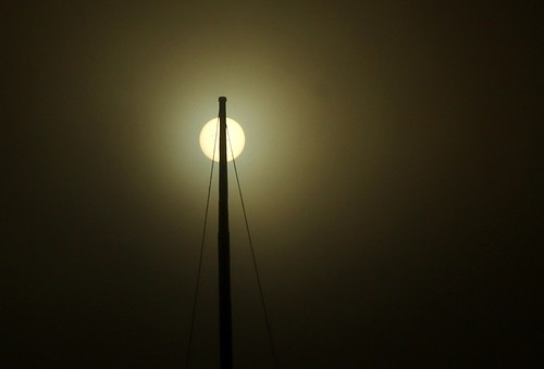
    IMG 9585  The Sun through Fog

    SOL
    - solar aspect of the newly risen Sun - on the East
    OM or AUM - the Sun shining on zenith, the highest point on horizon (the South)
    ON - the diminishing Sun, sunset on the West

    This trinity relates to the human condition and the threefold divisions in the life of humanity: birth, life and death.  Once again another trinity.  Thoughts feelings and actions.
Minus the vowels in the word SOLOMON you are left with the letters S L M N.
In the Hebrew language these letters are Samekh, Lamed, Mem, Nun. The gematric values are 60, 30, 40, 50.  Those numbers become 180.  180  is the number of degrees of the Suns journey from East to West. This is equated with the cycles of  Birth to Death.

Images @ Eminpee Fotography


A tsunami warning has been issued for the Solomon Islands, Vanuatu, Papua New Guinea, and Nauru after an 8.0. magnitude earthquake struck 70km off the Solomon Islands, according to USGS. “Widespread hazardous tsunami waves are possible,” stated the warning issued by the Pacific Tsunami Warning Center. READ MORE: http://www.disclose.tv/news/apocalyptic_80_earthquake_hits_solomon_islands__tsunami_warnings_issued/136913
7.8 EARTHQUAKE hits Solomon Islands - TSUNAMI WARNINGS issued! 2.8K A tsunami warning has been issued for the Solomon Islands, Vanuatu, Papua New Guinea, and Nauru after an SUPERMASSIVE 8.0. magnitude earthquake struck 70km off the Solomon Islands, according to USGS. “Widespread hazardous tsunami waves are possible,” stated the warning issued by the Pacific Tsunami Warning Center. UPDATES TO FOLLOW #Update 1: Downgraded to 7.8 TO - EMERGENCY MANAGEMENT IN THE STATE OF HAWAII SUBJECT - TSUNAMI WATCH A TSUNAMI WATCH IS ISSUED FOR THE STATE OF HAWAII EFFECTIVE AT 0748 AM HST. AN EARTHQUAKE HAS OCCURRED WITH THESE PRELIMINARY PARAMETERS ORIGIN TIME - 0739 AM HST 08 DEC 2016 COORDINATES - 10.7 SOUTH 161.4 EAST LOCATION - SOLOMON ISLANDS MAGNITUDE - 8.0 MOMENT BASED ON ALL AVAILABLE DATA A TSUNAMI MAY HAVE BEEN GENERATED BY THIS EARTHQUAKE THAT COULD BE DESTRUCTIVE ON COASTAL AREAS EVEN FAR FROM THE EPICENTER. AN INVESTIGATION IS UNDERWAY TO DETERMINE IF THERE IS A TSUNAMI THREAT TO HAWAII ( via rt.com ). IF TSUNAMI WAVES IMPACT HAWAII THE ESTIMATED EARLIEST ARRIVAL OF THE FIRST TSUNAMI WAVE IS 0256 PM HST THU 08 DEC 2016 READ MORE: http://www.disclose.tv/news/apocalyptic_80_earthquake_hits_solomon_islands__tsunami_warnings_issued/136913

Tuesday, August 25, 2015

Dubbo blown out by the Mother....

Storms were evident right across New South Wales yesterday.  We had storms here and there were storms at the coast and in Sydney and Kiama is on evacuation alert.  But what was a surprise was the Tornado that formed near Dubbo and left a trail of destruction in its wake damaging up to 12 properties in the area.  My niece was without power for 17 hours and they had no telephone either.  There is no mobile service to her property.  What would happen if something happened - how would we know.  I will have to mention a radio.

Please go here to Ch Nine and watch a thirty second video of this weather event.

Channel Nine News

There are pictures of the tornado forming over Dubbo.


 This afternoon this photo was taken and sent to Newcastle fishing trawlers to warn them of an incoming storm 20 mins after this shot was taken the storm hit trawlers the photo was taken by Newcastle fisheries observers such an incredible shot I was sent this via the captain of the trawler via a text msg at 3.30pm

IMG 3554 Funnel Cloud

I saw a funnel cloud outside my back door earlier this year and I was a little concerned but it blew out on the ocean, which was also out my back door.

Saturday, July 18, 2015

It Snowed in Deepwater and this Cold is Snapping Everyone!

Starting last weekend the temperatures dropped dramatically as an Arctic Vortex settled over most of New South Wales.   Of course its cold, it is Winter but these temperature drops were drastic.


Last night when we went to bed there was a definite chill in the air and I awoke to a complete white blanket of snow over everything.  It was still snowing when I went out to photograph this momentous event.  The locals say it hasn't snowed here for 60years.  My neighbour was out but really we were the only ones up seeing this auspiciousness take place.


The snow was heavy in those places that got snow last week and the highways were closed again because of so much snow on the roads.

 It started snowing in Queensland out near Toowoomba and this was forecast for last week and they were shivering. This time it really snowed.  It was forecast to snow in Stanthorpe last week  and that did lots for the local tourism but there was no snow in town but today it was over everything and it was a deep blanket.  There was also a lot of good snow at Eukey nearby to Stanthorpe and near Tenterfield at Mt Mt McKenzie.  These places are just over the border from Stanthorpe in Southern Queensland.


It snowed at Bolivia Hill where Brice and I went snow chasing but it wasn't white on the ground but it was floating in the air and I tried desperately to photograph this.  This time I got to photograph the snow on my boot with ease.  The flakes were so big.


We are up very high above sea level here, 974m above sea level and it snowed all over.  It was literally freezing temperatures all over.  The coastal areas are feeling the drops in temperatures as well.

This image below was snapped down the road from here at Guyra.  The link is under the pic to go and look at heaps more great images of last weeks and this weeks snow dumping up here on the New England.

Above the New England's Image

Images @ Eminpee Fotography- Bolivia

Friday, May 22, 2015

Shake rattle and Roll coming up ladies and gentleman.

IMG_2297
Julian Rocks Nimbin
I have said that we are in for the biggest time on Earth we have seen in our born days and I am nearing 56 as I type this.  Never before in our time will this have been witnessed not by even our great grandparents or their grand parents before this. 

The Earth peoples People like an apple tree produces apples.  We are one living organism the sum of many part in continuous change and birth and death and rebirth.  The Earth is now fully awake which has be evidenced by the 47 volcanoes erupting across the planet. 

This is a direct result of the activity of the sun and therefore the entire universe is privy to this upcoming action and has given the go ahead and all we can do is hang on.  I have seen a lot so far in my life of grief and sorrow and I think with what is to come my skills I have learned to cope will be invaluable because I do think we are in for a really rough time.


New Britain, Papua New Guinea

UTC time: Saturday, May 23, 2015 19:28 PM
Your time: Sunday, May 24 2015 5:28 AM
Magnitude Type: mww
USGS status: Reviewed by a seismologist

6.8 magnitude earthquake

UTC time: Friday, May 22, 2015 23:59 PM
Your time: Saturday, May 23 2015 9:59 AM
Magnitude Type: mww
USGS status: Reviewed by a seismologist

Images @ Eminpee Fotography

Tuesday, May 12, 2015

Might Snow???

The weather events lately have been extreme weather and there is much more to come as the Earth wakes from her slumber years and stretches and drops the fleas from her body that collected their while she rested with no permission. 


This photo was taken at 15:30hrs today on the Hume Hwy, Breadalbane (between Goulburn and Gunning).Take care if you are heading south this afternoon around the Gunning and Lake George areas.

Posted by Traffic and Highway Patrol Command - NSW Police Force on Tuesday, 12 May 2015
 
MIGHT SNOW here where we are in the New England as we are only 30m shy of the 1000m in the Northern Tablelands area

Partly cloudy. Areas of fog and patches of light frost on and west of the ranges early this morning. Slight (30%) chance of a shower in the late morning and afternoon. Snow possible above 1000 metres. Winds westerly 15 to 25 km/h turning southwesterly 20 to 30 km/h in the late afternoon. Daytime maximum temperatures between 11 and 21.

We had sleet earlier on today. You could see it floating on the air as it is lighter than rain.  It is also pretty too.  But it was a very cold day today and we were warmly tucked up in front of the fire for most of it.  Its nice to get out in the chilly weather though and see the cloud formations across this great big sky country here.  The clouds look like puffy squareish pillows sometimes in an endless repetitive sequence and these look amazing.
 

Images @ Eminpee Fotography

Wednesday, April 22, 2015

A New Chapter begins on the New England Highlands!

22nd day of the month and we unpack the Truck.... Number 22 is a number of power and accomplishment. 

Raleigh Removals - Dean and Jeff
I was excited this unpacking day fell on April 22.   This is because those two's do show up to me often.  The number 22 is a significant number which and is 2 appearing twice and this strengthens the message it is carrying.  The # 2 relates to our Divinity Path and our souls journey of learning.   Having this number significant shows the self to keep doing the great work.  The clear message here is to keep working consistently on my divine purpose which is the infinite consciousness (God) experiencing itself through creation.
  
Most everything was packed into the substantial shed that we now have.  It comes complete with a cement floor and lining and so our chatels were taken in there straight from the truck.  The old black hand painted fridge and my sadly rusting washing machine did however come in today while the boys were here to help as both are quite heavy and awkward to cart around alone. 

We have a lot of cleaning to finish off to be able to live alright, albeit a temporary clean for now.  So today while Brice helped the boys unpack the truck, I concentrated on cleaning the bathroom from top to bottom. 

After all of the hard work we carried out today we needed a great shower and a clean good bed so I was diligent and washed the walls in our bedroom, mopped the uncovered wooden floors and then  we put up our bed and made it with all the doonas we owned.

I felt good because I had cleaned the bathroom and toilet to a spick fashion. The kitchen too was given a fair good clean bench wise.  Tomorrow we will clean all of the cupboards.  Today was simply a huge day from start to finish too and today also started at about 4:30am.

When the removal boys arrived at our house this morning they were able to convey to us what had happened with the major weather event south of us where we are here at our beloved Dungog.

Dungog floods
Four people lost their lives in an absolute freak storm for that area.  It kind of shook Jeff Guest the removals guy up because only yesterday I was telling him the reason why we were leaving the coast to get to higher ground. 

I told him it was vitally important to me to get to a place where I could feel safer.    I  have been predicting strange things weather wise for some years now numbering about three years.  In my opinion being on the edge of the Pacific Ocean on a cliff which was really a midden  was not where I wanted to weather this weather event I think is on route.  My past recurring dreams of water hitting Dorrigo Mountain was a large contributing factor along with the fact I am a poor swimmer.
Images @ Eminpee Fotography

Tuesday, April 07, 2015

A Solar Canon ... on route to Earth


IMG 3682.1

A gigantic solar eruption on our star has projected a massive CME Earth facing.  It is said it will reach the Earth around Tuesday and given that was an US person saying this, then it will be here Monday which is right about now as we head into Tuesday just after midnight as tap away here.

The white coat priests (scientists) have given this latest huge explosion a label.  They called it "A canyon of Fire".  Science is scratching with all of this, most of it catching them completely off guard and so this is how they described this eruption.  This solar canyon is a magnetic stream said to be around 700,000 km long.

Mercury comes into solar conjunction shortly and there were eruptions on two sides and two more forming off to the side of the Earth.


The effects of any of the Coronal Mass Ejections reaching  Earth will most likely be vulcan related, volcanoes, earthquakes, and  severe weather,  A magnetic burst like this can effect the grid in some places and knock out electrical devices which are looking after major systems like aircraft and weather.


Images @ Eminpee Fotography

A huge solar eruption from the sun on Saturday has launched a giant CME towards earth which is expected to arrive on Tuesday.
The explosion which has been labelled as the ‘Canyon of Fire’ by scientists is a filament of magnetism approximately 700,000 km long.
The possible effects of the CME reaching the earth could be earthquakes, severe weather, and disruption to electronic devices. 
- See more at: http://yournewswire.com/huge-solar-canyon-of-fire-cme-from-sun-will-reach-earth-tuesday/#sthash.aHcK0ztR.dpuf

Friday, February 20, 2015

Extreme Weather:Cyclones and Coriolis

IMG 2869 A definite August Color Decision
Nature is wild and beautiful dangerous and loving.. like people

NEWS LINKS to CYCLONE MARSHA AND CYCLONE LAM:
Weatherzone


From the Bureau of Meteorology
The trough and approach of Marcia is producing heavy rain and locally damaging wind gusts about the Wide Bay and Burnett and Southeast Coast districts today. Currently, heaviest rain is located on radar near coastal parts from the Sunshine Coast to the Gold Coast. These conditions should extend inland to the eastern parts of the Darling Downs and Granite Belt district later today or tonight. This heavy rain may lead to flash flooding, with some 24 hour totals in excess of 300mm. Damaging wind gusts may reach around 90 km/hr, mostly near the coast and ranges.

Water levels on the high tide are likely to exceed the highest tide of the year tomorrow. Dangerous surf conditions and beach erosion are also expected on exposed beaches.

Riverine flooding:

Moderate flood warning for the Stanley and Mary rivers, minor flood warning for the Maroochy and Mooloolah rivers and Coochin creek.
A flood watch is current for the Wide Bay and Burnett, Southeast Coast and the Darling Downs & Granite Belt District forecast districts.

Locations which may be affected include Warwick, Gold Coast, Toowoomba, the Lockyer Valley, Ipswich, Brisbane, Caboolture, the Sunshine Coast, Kingaroy and Gympie.


Many locations near the coast from Brisbane up to the Sunshine Coast have had over 100mm of rainfall since 9am this morning with several locations having had over 150mm since 9am. Beachmere and Caboolture have both had over 180mm sonce 9am.

map as Marsha approaches

South Brisbane Storms
OZ Cyclone Chasers 

Satellite image as Marcia crosses coast makes land fall at
 
Australia uses a five category system based on wind speeds to grade cyclones.

Category 1: wind speeds up to 125 kilometres per hour, causing only slight damage.

Category 2: wind speeds up to 169 kilometres per hour, causing minor damage to buildings, severe damage to signs and trees, and heavy damage to crops.

Category 3: wind speeds up to 224 kilometres per hour, very destructive, causing structural damage to roofs and bringing down power lines.

Category 4: wind speeds of 279 kilometres per hour causing significant roofing and structural damage with a lot of airborne debris and widespread power failures.

Category 5: wind speeds over 280 kilometres per hour and capable of causing almost total destruction with buildings flattened and cars overturned.

Winds are measured by official weather bureau anemometers on the ground , although good estimates can also be made from satellite data. 
 

CORIOLIS:
Corioliskraftanimation.gif ‎
Perhaps the most important impact of the Coriolis effect is in the large-scale dynamics of the oceans and the atmosphere. In meteorology and oceanography, it is convenient to postulate a rotating frame of reference wherein the Earth is stationary. In accommodation of that provisional postulation, the centrifugal and Coriolis forces are introduced. Their relative importance is determined by the applicable Rossby numbers.

Tornadoes
have high Rossby numbers, so, while tornado-associated centrifugal forces are quite substantial, Coriolis forces associated with tornadoes are for practical purposes negligible.
Newton's laws of motion describe the motion of an object in a (non-accelerating) inertial frame of reference.

When Newton's laws are transformed to a uniformly rotating frame of reference, the Coriolis and centrifugal forces appear. Both forces are proportional to the mass of the object. The Coriolis force is proportional to the rotation rate and the centrifugal force is proportional to its square.

The Coriolis force acts in a direction perpendicular to the rotation axis and to the velocity of the body in the rotating frame and is proportional to the object's speed in the rotating frame. The centrifugal force acts outwards in the radial direction and is proportional to the distance of the body from the axis of the rotating frame. These additional forces are termed inertial forces, fictitious forces or pseudo forces.

They allow the application of Newton's laws to a rotating system. They are correction factors that do not exist in a non-accelerating or inertial reference frame.

A commonly encountered rotating reference frame is the Earth. The Coriolis effect is caused by the rotation of the Earth and the inertia of the mass experiencing the effect.

Because the Earth completes only one rotation per day, the Coriolis force is quite small, and its effects generally become noticeable only for motions occurring over large distances and long periods of time, such as large-scale movement of air in the atmosphere or water in the ocean.

Such motions are constrained by the surface of the earth, so only the horizontal component of the Coriolis force is generally important. This force causes moving objects on the surface of the Earth to be deflected to the right (with respect to the direction of travel) in the Northern Hemisphere and to the left in the Southern Hemisphere.

Rather than flowing directly from areas of high pressure to low pressure, as they would in a non-rotating system, winds and currents tend to flow to the right of this direction north of the equator and to the left of this direction south of it. This effect is responsible for the rotation of large cyclones (see Coriolis effects in meteorology).

To explain this intuitively, consider how an object that moves northwards from the equator has a tendency to maintain its greater speed at the equator (rotating around towards the right as you look at the sphere of the Earth), where the "horizontal diameter" is larger, and therefore tends to move towards the right as it passed northwards where the "horizontal diameter" of the Earth (the rings of latitude) are smaller, and the speed of local objects around the central axis of the Earth is slower.

METEROROLOGY:


Because currents are driven by the movement of wind across the water of the ocean, the Coriolis effect also affects the movement of the ocean’s currents and therefore hurricanes as well. Many of the ocean's largest currents circulate around warm, high-pressure areas called gyres. Though the circulation is not as significant as that in the air, the deflection caused by the Coriolis effect is what creates the spiraling pattern in these gyres. The spiraling wind pattern helps the hurricane form. The stronger the force from the Coriolis effect, the faster the wind will spin and pick up additional energy, increasing the strength of the hurricane.

Air within high-pressure systems rotates in a direction such that the Coriolis force will be directed radially inwards, and nearly balanced by the outwardly radial pressure gradient. As a result, air travels clockwise around high pressure in the Northern Hemisphere and counter-clockwise in the Southern Hemisphere. Air within low-pressure systems rotate in the opposite direction, so that the Coriolis force is directed radially outward and nearly balances an inwardly radial pressure gradient.

Images by Eminpee Fotography

Thursday, February 19, 2015

Eidsvold Queensland had a 'deep' Earthquake.

Explosion!
Kevin Dooley Flickr
Geoscience Australia said it released  the same amount of energy as a nuclear bomb exploding!

I learned something about earthquakes today.  The deeper they are the less dramatic is the effect.  So when they are very shallow, just a few Kilometers down there is a more devastating effect felt above ground.

The earthquake at Eidsvold in Central Eastern Queensland, which is inland of Gympie and close to the Gayndar orange growing district  was approximately 15 kilometers under the ground and that is considered deep.

People are not relating it to a "Frack Quake".   Those involved in the no CSG groups are careful to not say things that can be easily discredited with science, whether the science is faulty or not does not bother them.  But,  I checked maps and as the crow flies, it is not a great distance between the two places of Wondoan near Chinchilla  (where there is extensive fracking) to Eidsvold.

This coming weekend of the 20th February, we are having the highest of king tides for the entire year. This will coincide with an extreme weather event.   Two cyclones converging into one, already named 'Marsha'.

This event could cause a few disasters up the coast from here and people are preparing now.  I am situated on the coast  here, on a cliff over looking the Pacific Ocean.   The winds are expected to  reach 90kilometers.  I cant do much other than check my pot plants are all safe.

The Earthquakes and the extreme weather is a  response to the energies (forms of electricity) coming in from space.  During this week we had two M Class Flares and two Gamma Ray bursts from two differing star systems.  So it is no mistake the earth responds back to space this way. 

Earth and Space are in fact communicating with each other.  I am not sure if its a friendly wave or not.  What we see as friendly might be very different.

Read about the Geoscience reporting here at the ABC

IMG 8485 Urunga in Deluge

 More on the weather coming Here at the Sunshine Coast Daily

Gale force winds to come, as Queensland on cyclone alert.

Images @ Eminpee Fotography

Thursday, November 07, 2013

Typhoon Haiyan (Yolanda) completely slams the Phillipines.

 This is a very worrying weather event indeed of biblical proportions and some are saying it is the worst storm ever.  That is a big call.

SAM 8352 February Floods 2013  - URUNGA
Cyclonic conditions earlier this year in Urunga
 For More Information

Typhoon Haiyan (known in the Philippines as Typhoon Yolanda) is the second-deadliest Philippine typhoon on record, killing at least 3,631 people in that country alone.

The thirtieth named storm of the 2013 Pacific typhoon season, Haiyan originated from an area of low pressure several hundred kilometers east-southeast of Pohnpei in the Federated States of Micronesia on November 2. Tracking generally westward, environmental conditions favored tropical cyclogenesis and the system developed into a tropical depression the following day.

After becoming a tropical storm and attaining the name Haiyan at 0000 UTC on November 4, the system began a period of rapid intensification that brought it to typhoon intensity by 1800 UTC on November 5. By November 6, the Joint Typhoon Warning Center (JTWC) assessed the system as a Category 5-equivalent super typhoon on the Saffir-Simpson hurricane wind scale; the storm passed over the island of Kayangel in Palau shortly after attaining this strength.

Thereafter, it continued to intensify; at 1200 UTC on November 7, the Japan Meteorological Agency (JMA) upgraded the storm's maximum ten-minute sustained winds to 235 km/h (145 mph), the highest in relation to the cyclone. At 1800 UTC, the JTWC estimated the system's one-minute sustained winds to 315 km/h (195 mph), unofficially making Haiyan the fourth most intense tropical cyclone ever observed.

Several hours later, the eye of the cyclone made its first landfall in the Philippines at Guiuan, Eastern Samar, without any change in intensity; if verified, this would make Haiyan the strongest tropical cyclone to make a landfall on record, surpassing the old record of 305 km/h (190 mph) set by Atlantic Hurricane Camille in 1969. Gradually weakening, the storm made five additional landfalls in the country before emerging over the South China Sea.

The cyclone caused catastrophic destruction in the central Philippines, particularly on Samar Island and Leyte, where the governor estimated that at least 10,000 people may have died in the city of Tacloban alone.

According to UN officials, about 11 million people have been affected and many have been left homeless


Images @ Eminpee Fotography

Friday, September 27, 2013

On this day in history: first picture of a tornado in Australia - Australian Geographic

On this day in history: first picture of a tornado in Australia - Australian Geographic

This 1911 picture is believed to be the oldest one of a tornado in Australia. (Credit: Museum Victoria)
MR C. HOSKEN JUST happened to be in his backyard with a camera when a large tornado tore through the town of Marong, central Victoria, on the 27 September 1911.

As the tornado approached his property from the northwest, he began taking photographs. These images are believed to be the earliest photographic records of a tornado in Australia.

"It's almost unbelievable that in 1911 someone had a camera there...and this thing touched down virtually in his back yard," says Clyve Herbert, an avid tornado researcher from Melbourne Storm Chasers.
"I've searched for years and I've never found a photograph of a tornado in Australia as early as that."

A trail of tornado devastation

The storm lasted no more than half an hour. By the time the tornado had passed through Marong, and the thunder and falling hailstones had stopped, one person was dead and dozens more injured. In the nearby outback town of Lockwood, every building was levelled, trees were stripped of their bark, and hundreds of metres of fencing was carried away.

These scenes were also captured on film by Hosken, providing lasting evidence of the scale of damage.
"They found a six-tonne gold crushing machine carried three to four miles into the forest, which gives you some idea of the strength of [the tornado]," Clyve says. "There are not a lot of entries about how many were injured in Lockwood, but the entire town was almost obliterated."

At the time, the Bureau of Meteorology called the Marong Tornado one of the most violent and destructive events in Australia's meteorological history.


The Ballarat tornado of 2007 was one of several large storms to hit the "tornado triangle" in recent years. (Credit: Clyve Herbert)

Tornado rating scale

The Fujita Scale - which rates a tornado between F0 and F5, depending on intensity and destruction - wasn't around in 1911, but Clyve says Hosken's photographs, and a 1911 BOM report, suggest it may have been F3. This same rating was given to the 1976 Sandon Tornado, which touched down a few kilometres to the south of Marong and, according to Clyve, had a similar path and lifespan.

He calls the region bounded by Daylesford, Seymour, Bendigo and Maryborough the "tornado triangle" because of the many extreme weather events that have occurred there.
Enhanced by Zemanta