Showing posts with label Cyclones. Show all posts

Saturday, September 09, 2017

Hurricanes and cyclones and Science

Intense hurricanes ... The lower the millibars the higher the hurricane system.  Right now the strongest storm in history of the coast off Miami heading toward Georgia.  They are expecting landfall on September 11th.  I am sure its going to be very awful.  Our sun has had several M Class Solar flares release 2 days ago and yesterday a X Class Flare shot off the Sun and this will create massive weather all across the planet.


A Millibar (symbol mb or mbar) is a meteorological unit of pressure equal to one-thousandth of a bar. A bar is a c.g.s. unit of pressure (A system of units based on the centimetre, gram, and second) equal to 1,000,000 dynes per square centimeter, or 100,000 pascals (symbol Pa). Thus one millibar is equivalent to 100 pascals or one hectopascal.

 No automatic alt text available.


IMG 0778 Full Moon Tinted Red 

Tuesday, March 28, 2017

Cyclone Debbie, the eyes of the nation watch North Queensland.


 Cyclone Debbie is bearing down on the North Queensland coast around Mackay and the Whitsunday Islands.  Forecast to cross the coast just before 11:00am today Tuesday, 28th March.   Wind gusts forecast to be 250klm an hour.

 http://www.abc.net.au/news/2017-03-28/cyclone-debbie-makes-landfall-in-north-queensland-live-blog/8391312

The main concern for the Mackay area is the storm surge with the high tide occurring simultaneously!  Will Debbie make the list of worst cyclones ever to hit the coast of Queensland.


 Live streaming to ABC North Queensland here : https://radio.abc.net.au/stations/itinerant_one/live

 A bit of History on Australian cyclones since white settlement.

 1899 - Category five Tropical Cyclone Mahina  March 4th
Over 400 people killed and the storm surge left porpoises on the tops of cliffs and the destruction was made worse by another cyclone Monsoonal Disturbance Nachon coming at them from the west over the Arafura Sea at the same time.

1918 - Category four Tropical Cyclone Mackay.  January 21st
30 lives were lost in Mackay when this cyclone crossed the coast.  Reports of wave coming into the main street up to 9ft high which is about 3 meters. 

1918 - Category five Cyclone Innisfail.  March 10th
Just after Mackay in January it was Innisfail's turn in March and only 12 houses in the town left standing and 100 people dead in the area.

2006 - Category four Cyclone Larry Innisfail.  March 20th
Worst in three generations the BOM said and that is correct .. since 1918.  10,000 homes were damaged and crops were lost and the economic loss was around $1.5 Billion  and no lives were lost.

2011 - Category five Cyclone Yasi at Far North Queensland at Mission Beach.  February 3rd
Wind gusts estimated at 285 kilometres per hour. Yasi tracked 1000 kilometers inland to Mt Isa with the intensity of a tropical low over the next 20 hours.

Devastation in Edith Street, Innisfail after a cyclone in 1918
Image of Innisfail March 10th 1918  Photo State Library of Queensland

The Cyclone is a large one and the weather reports show it tracking inland when it finally makes land fall and heading in sweeping southerly direction above or around Emerald. 

Brisbane and the Gold Coast and Northern NSW will need to brace themselves as the rain sweeps down pushed by arctic winds from the south.  

I have organized sandbags for the side of our shed from the local SES.  My friend has already received an SMS warning from her insurance company to expect up to 400m of rain in this area where we are on the mountain.  This is why I organized sandbags.  One side of the shed is vulnerable and my furniture is in there.  Better to do it now that when its too late.

UpDate 31st March 2017: Earlier this morning ... The omens were in the sky. The big birds ... lots of gigantic wings and then a heart. This is a personal omen and in past times it has always been death.

Image may contain: sky, cloud and outdoor

Image may contain: cloud, sky, night, outdoor and nature

Image may contain: sky, cloud, tree, outdoor and nature

UpDate 3rd April 2017:  5 people dead and 3 still missing.
http://www.news.com.au/technology/environment/queensland-cyclone-debbie-five-people-killed-in-horror-weather/news-story/1d2d9148a0f3e4500f4da13540d17628

Update from New Zealand 3rd April 2017 :  The remnants of Tropical Cyclone Debbie are threatening to develop into a serious situation in the next 72 hours
http://m.nzherald.co.nz/nz/news/article.cfm?c_id=1&objectid=11830617

Images @ Eminpee Fotography

Monday, February 22, 2016

FIJI APPEAL FOR HELP!


***TC WINSTON FIJI DONATION APPEALS & DETAILS***
***Share and Give ***

Severe tropical cyclone Winston category 5 directly impacted Fiji and maritime islands on Saturday causing unimaginable damage and destruction. Sadly the death toll has risen to 10 with fears this will rise further. 1000's of homes and crops have been damaged or destroyed displacing 1000's of lives.
***FIJI NEEDS OUR HELP & SUPPORT***

Pacific Smiles
is based in Brisbane and are a registered charity providing relief to Fiji. They are collecting goods donations to fill a 40ft shipping container to send to Fiji ASAP, they also require $20,000 in cash to get it there.
DROP OF DONATION POINTS: ( Goods to be boxed and clean working order ) Brisbane - Wynnum, Underwood, Springfield & Springfield Lakes. Gold Coast - Nerang, Upper Coomera. Please Email for address details reeree04@msn.com

GO FUND ME: https://www.gofundme.com/kadavu2016
DIRECT DEPOSIT: National Australia Bank, Account Name - Pacific Smiles, BSB - 084134, Account no. - 196826487

CARE Australia
You can help communities devastated by natural disaster by donating to CARE’s Cyclone Winston Appeal.
In Fiji, CARE partners with the non-government network Live & Learn to provide emergency response advice and support. Our teams on the ground are working to assess the damage caused by the storm and are set to support the Fiji Government in any emergency response efforts. Our emergency response experts are ready to support the most vulnerable, including women and girls. It’s highly likely there will be urgent need to provide shelter and access to clean and safe water.
We need your help to respond to communities devastated by natural disaster. Please give generously to CARE’s Cyclone Winston Appeal. https://www.care.org.au/a…/cyclone-winston-emergency-appeal/

Save the Children Australia
Please donate now. Save the Children is responding
Aid workers from Save the Children globally are gearing up to deploy to the worst affected areas. We have: teams ready to assess the damage once the curfew lifts
teachers ready to support children in evacuation centres. To start, we will operate special playgroups for children staying in some of the 700-plus evacuation centres across the country.
stockpiled emergency supplies to ensure children return to school as soon as possible. This includes school bags, classroom kits and child friendly spaces kits for evacuation centres if schools are damaged.
https://www.savethechildren.org.au/donate/cyclone-winston


Friday, March 13, 2015

So Many Cyclones they're Multiplying!

Olywyn ... Nathan .. Pam!     Mathematically speaking its adding up to be a devastating time on the Island of Vanuatu in the Pacific east of Queensland.  Cyclone Pam is circling for the impact.

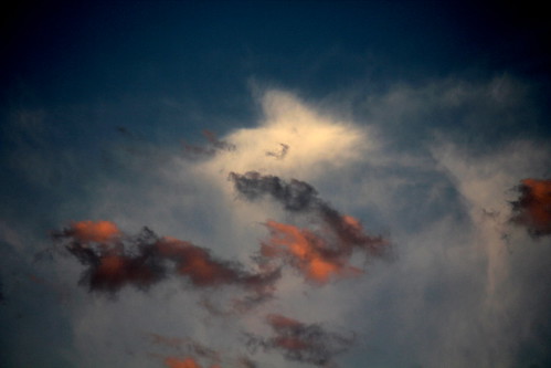
IMG 8881  Mad Clouds with a white heart cloud
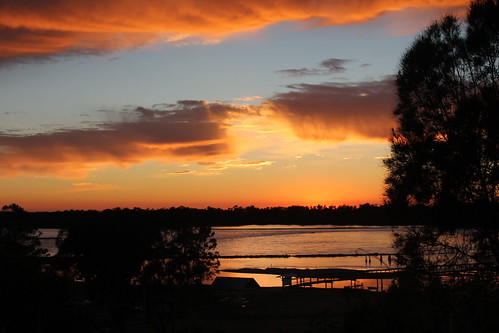
Red Sky in the Morning - Sailors Warning!
 
Australian coastlines are set to take a pounding again as cyclones close in on three sides while others keep watch further out to sea working out whether to make land fall or not. 


Weather is nuts at the moment.  No wonder it is though.  The Sun just let go of some might filled zingy  M Class Flares during this last week and we all know this means a serious Earth Weather event / volcanic or earthquake type event is on route.  I am on Earthquake watch as I write this.

Read More  with Aussie Cyclone Chasers reports on the Cyclonic conditions battling to make their way felt in Australia at the moment as the weekend approaches.

Cyclone Olwyn is battering the West Australian Coastline and looks like making land around Exmouth WA and Barrow Island.  People are battening down the best they can.  There appears to be a weather station off line in that area also which may be due to the cyclonic conditions.

Olywins Eye clearly visible.
Vanuatu is looking like an island in trouble with a Category 5  Cyclone "Pam" looking fierce. It is inevitable the damage toll will be high. 

If that isn't enough there could be further instances of trouble occurring  with Cyclone Nathan sitting off Cooktown Far North Queensland looking a lot like its going track back and head back across to Vanuatu to help Pam with her weather walloping.

Images @ Eminpee Fotography

Monday, February 23, 2015

TC LAM Northern Territory - Government makes it a Black and White Cyclone

Donate to the CROWD FUNDING APPEAL .
https://ozcrowd.com/campaigns/arnhem-land-tc-lam-urgent-supplies-needed/?updated=true#.VOkejiknxUS


https://ozcrowd.com/wp-content/uploads/edd/2015/02/11001832_768712596558085_4498588335056765191_n.jpg
Image - Oz Crowd funding

I shared the funding website as far and as wide as I possibly could to as many as possible and even asked people to donate if they could, I felt if we were on benefits and could send a few dollars, others earning much more could do the same. 

I posted the Oz Crowd link to Lock the Gate page and apologized for it being out of context with the page.  I felt it may reach a few hundred people there who may want to help because there are so many like minded people as myself visit that facebook page for csg updates etc and so I posted.

I was aware of page rules and this is why apologized straight up so that I could not be seen as not knowing the page rules.  One punter continually barged her immature point of view over and over and over and.  It made it difficult for me to be civil, given what I have seen personally regarding the treatment of indigenous in this country in all situations

After repeated posts from this same person (who goes by the name of Melinda Johnson)  it was evident this person was a government lover or  a troll or perhaps even Vee Ness.    That strange woman used the name Johnson as a surname on one of the false profiles of hers we busted out.

There was repeated sour grapes posts regarding this woman's disgust that lock the gate would not take down the appeal post I posted to LTG.   She turned on Judith and I who were answering her endless questions.  She took her posts down and it made us guys look like a couple of whack jobs posting between ourselves. 

Next morning surprisingly LTG had not taken the post down.   Many people had seen the post and I hope some of those folk have donated  and shared the TC LAM CYCLONE RELIEF PAGE far and wide also. 

However, like clockwork there was another comment from this same lady again, Melinda Johnson, offering a rather lame two pronged apology in order to have another go at me and the fact that LTG had not taken the post down and to purposefully stand up for the corrupt government and tell me that 'Government have not turned their backs'.
UPDATE to TC LAM APPEAL LAST Night! 8:12pm
Arnhem Time 23/2/15 UPDATE:

We were informed today by the Chief Ministers Dept. that Milingimbi, Ramingining and Galwin’ku (Elcho), all now have access to clean and safe drinking water. The alert for boiling water has ceased. We are so so happy to hear this. There is still a lot of work to do and still a lot of people living in shelters/sheds and unable to return to their homes. There are still trees everywhere and locals are tirelessly trying to clean there houses and make repairs with extremely limited resources. Please keep spreading the word about our campaign and donating, every $1, is a heartfelt contribution that is appreciated and contributing to a great cause. Thanks (from crowd funding site)

Saturday, February 21, 2015

Flood Warning For Bellinger River.

Tropical Cyclone Marcia will go down in record as being the furthermost south a tropical cyclone has made landfall.


IMG 5864
Looking towards the Pacific Ocean in Urunga.

  • Australian Government Bureau of Meteorology
    New South Wales MINOR FLOOD WARNING FOR THE BELLINGER RIVER

    Issued at 1:43 pm EDT on Saturday 21 February 2015
    Flood Warning Number: 2

    An average of 75 millimetres of rain has fallen during the past 36 hours to 1pm today [21/02/15].  However, the rain intensity has increased during the past 6 hours.
    Further rain is forecast for the remainder of today.
    This forecast rain is expected to cause minor flooding at Thora this evening [21/02/15].
    At this stage it is not possible to predict the flood peak because of uncertainty over how much more rain will fall.

    Predicted River Heights/Flows:
    Thora:
    - with forecast rain reach minor flood level (3 metres) around 11pm Saturday [21/02/15]
    Bellingen:
    - remains below minor flood level
    Urunga:
    - remains below minor flood level

    FloodSafe advice is available at www.ses.nsw.gov.au
    For emergency assistance call the SES on telephone number 132 500.
    For life threatening emergencies, call 000 immediately.
    Weather Forecast:
    For the latest weather forecast see www.bom.gov.au/nsw/forecasts/
    Next Issue:
    The next warning will be issued by 5pm Saturday [21/02/15].

    Latest River Heights:
    Bellinger R at Thora 2.37m rising 01:24 PM SAT 21/02/15
    Never Never Ck at Gleniffer 1.26m rising 01:32 PM SAT 21/02/15
    Bellinger R at Bellingen Br 1.96m rising 01:33 PM SAT 21/02/15
    Kalang R at Kooroowi (Scotchman) 1.23m rising 01:37 PM SAT 21/02/15
    Kalang R at Newry Island 1.06m falling 01:38 PM SAT 21/02/15

    For latest rainfall and river level information see www.bom.gov.au/nsw/flood/
    Issued by: The Bureau of Meteorology, Supplied to the ABC by: Weatherzone
    For further information or additional warnings visit: http://www.bom.gov.au/

Friday, February 20, 2015

Extreme Weather:Cyclones and Coriolis

IMG 2869 A definite August Color Decision
Nature is wild and beautiful dangerous and loving.. like people

NEWS LINKS to CYCLONE MARSHA AND CYCLONE LAM:
Weatherzone


From the Bureau of Meteorology
The trough and approach of Marcia is producing heavy rain and locally damaging wind gusts about the Wide Bay and Burnett and Southeast Coast districts today. Currently, heaviest rain is located on radar near coastal parts from the Sunshine Coast to the Gold Coast. These conditions should extend inland to the eastern parts of the Darling Downs and Granite Belt district later today or tonight. This heavy rain may lead to flash flooding, with some 24 hour totals in excess of 300mm. Damaging wind gusts may reach around 90 km/hr, mostly near the coast and ranges.

Water levels on the high tide are likely to exceed the highest tide of the year tomorrow. Dangerous surf conditions and beach erosion are also expected on exposed beaches.

Riverine flooding:

Moderate flood warning for the Stanley and Mary rivers, minor flood warning for the Maroochy and Mooloolah rivers and Coochin creek.
A flood watch is current for the Wide Bay and Burnett, Southeast Coast and the Darling Downs & Granite Belt District forecast districts.

Locations which may be affected include Warwick, Gold Coast, Toowoomba, the Lockyer Valley, Ipswich, Brisbane, Caboolture, the Sunshine Coast, Kingaroy and Gympie.


Many locations near the coast from Brisbane up to the Sunshine Coast have had over 100mm of rainfall since 9am this morning with several locations having had over 150mm since 9am. Beachmere and Caboolture have both had over 180mm sonce 9am.

map as Marsha approaches

South Brisbane Storms
OZ Cyclone Chasers 

Satellite image as Marcia crosses coast makes land fall at
 
Australia uses a five category system based on wind speeds to grade cyclones.

Category 1: wind speeds up to 125 kilometres per hour, causing only slight damage.

Category 2: wind speeds up to 169 kilometres per hour, causing minor damage to buildings, severe damage to signs and trees, and heavy damage to crops.

Category 3: wind speeds up to 224 kilometres per hour, very destructive, causing structural damage to roofs and bringing down power lines.

Category 4: wind speeds of 279 kilometres per hour causing significant roofing and structural damage with a lot of airborne debris and widespread power failures.

Category 5: wind speeds over 280 kilometres per hour and capable of causing almost total destruction with buildings flattened and cars overturned.

Winds are measured by official weather bureau anemometers on the ground , although good estimates can also be made from satellite data. 
 

CORIOLIS:
Corioliskraftanimation.gif ‎
Perhaps the most important impact of the Coriolis effect is in the large-scale dynamics of the oceans and the atmosphere. In meteorology and oceanography, it is convenient to postulate a rotating frame of reference wherein the Earth is stationary. In accommodation of that provisional postulation, the centrifugal and Coriolis forces are introduced. Their relative importance is determined by the applicable Rossby numbers.

Tornadoes
have high Rossby numbers, so, while tornado-associated centrifugal forces are quite substantial, Coriolis forces associated with tornadoes are for practical purposes negligible.
Newton's laws of motion describe the motion of an object in a (non-accelerating) inertial frame of reference.

When Newton's laws are transformed to a uniformly rotating frame of reference, the Coriolis and centrifugal forces appear. Both forces are proportional to the mass of the object. The Coriolis force is proportional to the rotation rate and the centrifugal force is proportional to its square.

The Coriolis force acts in a direction perpendicular to the rotation axis and to the velocity of the body in the rotating frame and is proportional to the object's speed in the rotating frame. The centrifugal force acts outwards in the radial direction and is proportional to the distance of the body from the axis of the rotating frame. These additional forces are termed inertial forces, fictitious forces or pseudo forces.

They allow the application of Newton's laws to a rotating system. They are correction factors that do not exist in a non-accelerating or inertial reference frame.

A commonly encountered rotating reference frame is the Earth. The Coriolis effect is caused by the rotation of the Earth and the inertia of the mass experiencing the effect.

Because the Earth completes only one rotation per day, the Coriolis force is quite small, and its effects generally become noticeable only for motions occurring over large distances and long periods of time, such as large-scale movement of air in the atmosphere or water in the ocean.

Such motions are constrained by the surface of the earth, so only the horizontal component of the Coriolis force is generally important. This force causes moving objects on the surface of the Earth to be deflected to the right (with respect to the direction of travel) in the Northern Hemisphere and to the left in the Southern Hemisphere.

Rather than flowing directly from areas of high pressure to low pressure, as they would in a non-rotating system, winds and currents tend to flow to the right of this direction north of the equator and to the left of this direction south of it. This effect is responsible for the rotation of large cyclones (see Coriolis effects in meteorology).

To explain this intuitively, consider how an object that moves northwards from the equator has a tendency to maintain its greater speed at the equator (rotating around towards the right as you look at the sphere of the Earth), where the "horizontal diameter" is larger, and therefore tends to move towards the right as it passed northwards where the "horizontal diameter" of the Earth (the rings of latitude) are smaller, and the speed of local objects around the central axis of the Earth is slower.

METEROROLOGY:


Because currents are driven by the movement of wind across the water of the ocean, the Coriolis effect also affects the movement of the ocean’s currents and therefore hurricanes as well. Many of the ocean's largest currents circulate around warm, high-pressure areas called gyres. Though the circulation is not as significant as that in the air, the deflection caused by the Coriolis effect is what creates the spiraling pattern in these gyres. The spiraling wind pattern helps the hurricane form. The stronger the force from the Coriolis effect, the faster the wind will spin and pick up additional energy, increasing the strength of the hurricane.

Air within high-pressure systems rotates in a direction such that the Coriolis force will be directed radially inwards, and nearly balanced by the outwardly radial pressure gradient. As a result, air travels clockwise around high pressure in the Northern Hemisphere and counter-clockwise in the Southern Hemisphere. Air within low-pressure systems rotate in the opposite direction, so that the Coriolis force is directed radially outward and nearly balances an inwardly radial pressure gradient.

Images by Eminpee Fotography

Thursday, February 21, 2013

A Sub -Tropical Low is similar to a cyclone only further south.

The east coast of Australia prepares to batten down the hatches as another out of character subtropical low forms off the east coast of SE Queensland and Northern New South Wales in the Pacific Ocean.

IMG 5864 
The low pressure system is promising to bring a lot of rain and everyone is on flood alert.   This type of rain is sure to be another decent flood in the making.  Our local  Coffs Harbour / Bellingen area is on flood watch for moderate to serious flooding. 

Further north in the state  in the town of Grafton, they recently escaped with a centimeter to go before all hell broke loose in the last flood .  This was three weeks ago, the memory is very fresh and  people are still recovering in many of the outlying areas to these major townships. 

It is tough slog when the weather is like this.  People try so hard to keep their chins up.   I suspect there is a lot of crying going on in private behind closed doors and closed tents.  Putting on a brave face didn't really help anyone ever.  We know all know it is tough and it's alright to say you are broken and have had enough for now.  When you lose your life's memories it is heart breaking.  I wish I could help in a more effective way.  I hate to see humanity suffer in the ways we do.

IMG 3647 No Gas! Moore Park Action 

To quote my friend Joe Walker who lives in this area:
 "Our weather pattern has shifted 150km to North due to 'Climate Change' which now may be happening 6 times faster than expected probably due to ENORMOUS Methane emissions Northern Hemisphere! Sydney will have the climate of Rockhampton! The only place that will have 'proper' seasons in Australia will be Tasmania"
I agree, we cannot keep doing what we are doing to the planet and expect picnic weather everyday.  The weather will be the way the planet spits us off of her.   She will do this because we are like a blood sucking parasite on her body and she will be applying the salve very soon I feel to remove this.

Images @ Melonpopzdropz Flickr

Enhanced by Zemanta